
Marine Plans
Or call us at 1-855-796-9847
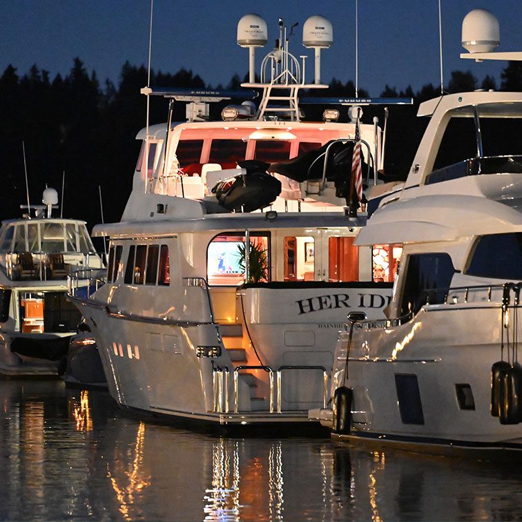
SiriusXM Marine Inland
Radar & Lightning
SiriusXM Marine Coastal
Wind & Wave Info
Radar & Lightning
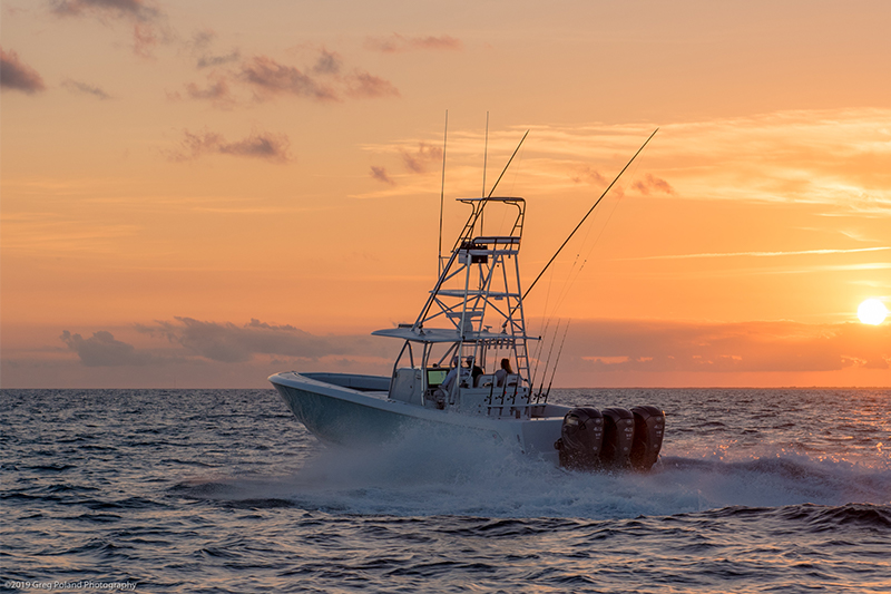
SiriusXM Marine Offshore
Surface Temps
Wind & Wave Info
Radar & Lightning
SiriusXM Fish Mapping
Fish Mapping
Surface Temps
Wind & Wave Info
Radar & Lightning
App Access
Compare SiriusXM Marine Plans
Select Marine plans with the dropdowns to compare their features
Package Features
Fees, taxes and Offer Details apply. | |||||
|---|---|---|---|---|---|
Plan | SiriusXM Marine Inland | SiriusXM Marine Coastal | |||
NEXRAD Storm Cell Attributes | NEXRAD Storm Cell Attributes | Included | Included | ||
Weather Radar | Weather Radar | Included | Included | ||
Cloud-to-Cloud and Cloud-to-Ground Lightning Strikes | Cloud-to-Cloud and Cloud-to-Ground Lightning Strikes | Included | Included | ||
Tropical Storm Tracks with Windfields Observed | Tropical Storm Tracks with Windfields Observed | Included | Included | ||
Alerts Service | Alerts Service | Included | Included | ||
Weather Watch Boxes | Weather Watch Boxes | Included | Included | ||
Local 5 Day Weather Forecasts | Local 5 Day Weather Forecasts | Included | Included | ||
Offshore Surface Wind Forecasts | Offshore Surface Wind Forecasts | Included | 0-3 Hr | ||
High-Resolution Coastal & Inland Surface Wind Forecasts | High-Resolution Coastal & Inland Surface Wind Forecasts | Included | 0-3 Hr | ||
Weather Map with Surface Features & Isobars | Weather Map with Surface Features & Isobars | Included | 0-24 Hr | ||
Offshore Forecast Wave Height, Period & Direction | Offshore Forecast Wave Height, Period & Direction | Not included | 0-3 Hr | ||
High-Resolution Coastal Wave Heights | High-Resolution Coastal Wave Heights | Not included | 0-3 Hr | ||
Great Lakes Forecast Wave Height, Period & Direction | Great Lakes Forecast Wave Height, Period & Direction | Not included | 0-3 Hr | ||
Marine Warnings | Marine Warnings | Not included | Included | ||
Marine Zone Forecasts | Marine Zone Forecasts | Not included | Included | ||
Tropical Weather Statements | Tropical Weather Statements | Not included | Included | ||
METARs | METARs | Not included | Included | ||
Marine Observations (buoys) | Marine Observations (buoys) | Not included | Included | ||
Cloud Top Images | Cloud Top Images | Not included | Included | ||
High-Res Coastal Sea Surface Temps to 24NM Limit | High-Res Coastal Sea Surface Temps to 24NM Limit | Not included | Included | ||
Offshore Sea Surface Temperatures beyond 24NM Limit | Offshore Sea Surface Temperatures beyond 24NM Limit | Not included | Not included | ||
Fishing Recommendations | Fishing Recommendations | Not included | Not included | ||
Weed Lines | Weed Lines | Not included | Not included | ||
Sea Surface Height Anomaly | Sea Surface Height Anomaly | Not included | Not included | ||
Sea Surface Temperature Contours | Sea Surface Temperature Contours | Not included | Not included | ||
Sea Surface Temperature Front Strength | Sea Surface Temperature Front Strength | Not included | Not included | ||
30m Subsurface Sea Temperatures | 30m Subsurface Sea Temperatures | Not included | Not included | ||
Plankton Concentration Contours | Plankton Concentration Contours | Not included | Not included | ||
Plankton Front Strength | Plankton Front Strength | Not included | Not included | ||
Fish Mapping App Access | Fish Mapping App Access | Not included | Not included | ||
150+ Channels of SiriusXM Satellite Radio Programming2 | 150+ Channels of SiriusXM Satellite Radio Programming2 | Additional subscription required | Additional subscription required | ||
View Legacy Sirius Marine Devices and Plans | View Legacy XMWX Marine Devices and Plans
Help and Support
Haven’t taken the boat out in a while? We can send a "wake up" signal to your hardware.
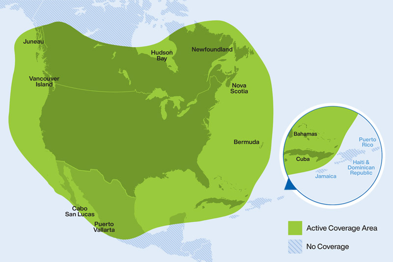
SiriusXM Marine service is available in the continental United States, southern Canada and coastal regions, up to 150 nautical miles offshore.
Call 1-855-796-9847 or email marine.support@siriusxm.com for personalized help with SiriusXM Marine. You can also log in to your account if you have account specific issues.
FAQS
You can suspend your SiriusXM Marine Weather service at no cost for up to 6 months when you are not using it by calling 1-800-985-9200 and asking to suspend.
The Weather Company (formerly WSI), the industry-leading weather information supplier, is the source for SiriusXM Marine Weather. TWC combines NOAA data with information from other...
SiriusXM Marine coverage area includes southern Canada. Canadian residents can subscribe to SiriusXM Marine.
No. You can subscribe on a month-to-month basis. SiriusXM will bill your credit card monthly in advance, and you may cancel your subscription at any time. There will be a $25 activation fee when...
OFFER DETAILS: The SiriusXM Marine subscription plan you choose will automatically renew thereafter and you will be charged according to your chosen payment method at then-current rates. Fees and taxes apply. Please see our Customer Agreement for complete terms and how to cancel, which includes calling us at 1-800-985-9200. All fees, content, and programming are subject to change.
1Inland Hardware and Service Info: Inland package is only available on Simrad, Lowrance, and B&G hardware. Viewable within 80-mile radius of vessel in Vessel Mode, but can be viewed within 80-mile radius of the cursor position in Browse Mode. The viewing is restricted to approximately 10NM seaward from shorelines.
IMPORTANT INFORMATION: The SiriusXM Service may include traffic, weather and other content and emergency alert information and data. Such information and data is not for "safety for life," but is merely supplemental and advisory in nature, and therefore cannot be relied upon as safety critical in connection with any aircraft, sea craft, automobile, or any other usage. Service not available in AK or HI.
2SiriusXM Satellite Radio is sold separately and may be purchased at a discounted rate when added to Marine service. A $15 activation fee applies if audio is activated separately from SiriusXM Marine service.
Fish Mapping App: The Fish Mapping App is only available with your Fish Mapping subscription and subscriptions require a compatible satellite-enabled device. The Fish Mapping App is not sold separately. Access to the app may take up to 24 hours from subscription activation to process and access is limited to 2 devices. Internet access is required for the Fish Mapping App. Data rates may apply. Subscription and service fees, content, and features are subject to change.